The KHEAM Project is well underway and MGI has so far completed Phase A of the fieldwork activities. State-of-the-art equipment and technology were utilized to obtain data critical to understanding conditions experienced in the environment and how they influence the movement of buoyant solid waste litter within the harbour. The Implementation of Ecosystem Adaptation Measures for Kingston Harbour communities “KHEAM” is an environmental project which aims to bolster the defence of vulnerable, low-lying areas of the city of Kingston against the climate risks of flooding, storm surges, and hurricanes through mangrove restoration, rehabilitation, and conservation within the Kingston Harbour.
Various loggers were deployed between May and June 2021 and retrieved within a 3-week window.

The Acoustic Doppler Current Profiler, or ADCP for short, measures the speed and direction of currents as they pass over the equipment (Fig 1). By understanding this data, we can properly determine and understand sub-surface current dynamics within the harbour.

The Automated Weather Station (AWS) was stationed at the Port Royal Marine Lab (Fig 2) where it logged data such as temperature, rain volume, humidity, wind speed and direction, barometric pressure as well as other parameters of hour-to-hour atmospheric conditions.


The Tide Gauge is a water level monitoring system used to continuously record changes in the day-to-day sea level in the Harbour (Fig 3). This instrument was also stationed at the Port Royal Marine Lab.

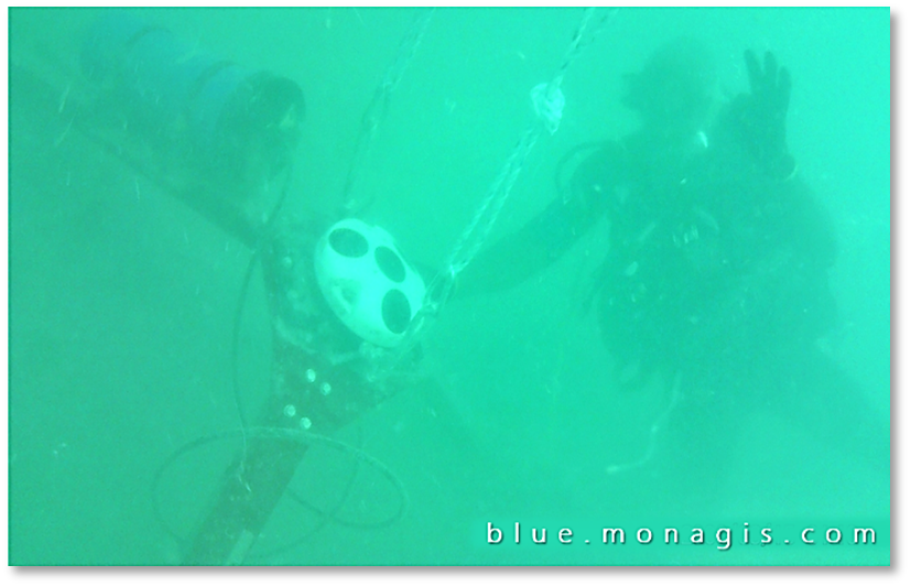
The Tilt Current Meter (TCM) is designed to measure subsurface current velocities under the drag-tilt principle (Fig 4). While an object submerged will experience current flow, a tethered object will experience some form of tilt as it moves as a function of velocity, buoyancy, drag and mooring tension due to the cord connecting the instrument to the base. Paired with the TCM is the Pressure Temperature Sensor, or PT2X. This is designed to record pressure and temperature of the seafloor.

The team accurately marked the locations of equipment deployed using GPS Garmin units, as well as using surface buoys so that they could be easily found once the data collection period was over. There were a few occasions when rough seas and turbid waters presented challenges while retrieving equipment. We are however happy to report that all equipment deployed were successfully retrieved and the data from these instruments are now being analyzed.
The next deployment phase is scheduled to commence in another 6 months.
